Unit 4: Geography
Essential Question: How do maps and tools of geography help us understand the world?
|
Mapping Vocabulary
|
|
|
|
Module 1 - Latitude and Longitude
After reviewing the notes, students practiced determining latitude and longitude coordinates on maps. The following handouts were used to practice these skills. If you are doing this assignment outside of class, the continents listed after them are maps that we practiced with in class. Those maps are not copied on the assignments below, as you do not have to make that up. Assignment: Latitude and Longitude (South America) Assignment: Latitude and Longitude (Australia) Assignment: Latitude and Longitude (Africa) Lines on Earth - Balloon Activity. If you were not in class to practice drawing important cartography lines on a balloon as a model of the earth, you will need to follow the directions below to complete the assignment. Assignment: On a blank piece of paper, draw two circles. Each circle represents opposite views of the earth. On the circles you need to draw and label each of the following:
|
Latitude and Longitude Class Notes (Click on the notes image to flip to the next page)
|
|
Module 2 - Projections
Selecting a Map Projection National Geographic Video. More information on map distortion Website of projection examples - fun site to explore Assignment: How to pick a good map projection Use the handout linked above, a globe and the map projections blow to determine distortion. Important: You need a globe and string to complete this activity. Extra: There are some people that have criticised the Mercator Projection. They have claimed that it is 'racist.' To learn about this claim, read the following article and watch the video to the right. There is no assignment for this. It's just interesting!
Spotlight on Projection Controversy |
|
|
Module 3 - Political, Physical, and Thematic Maps
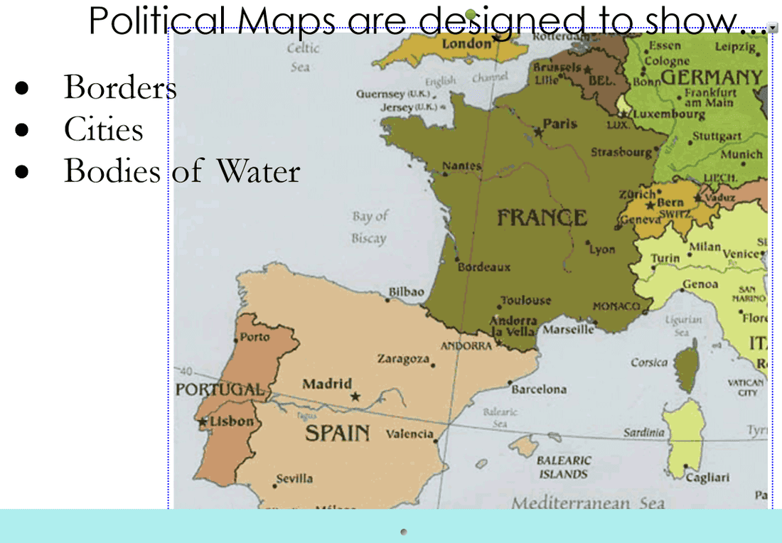
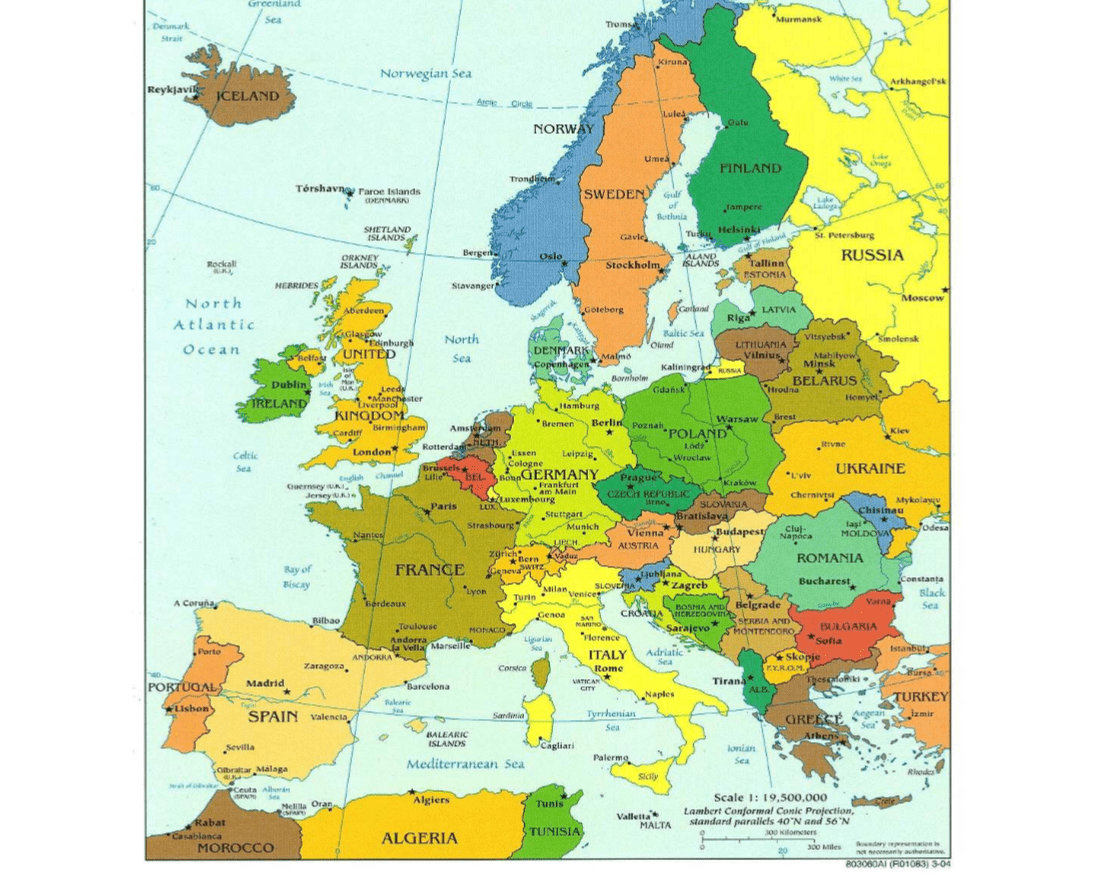
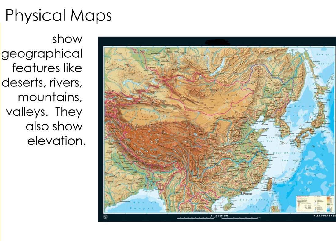
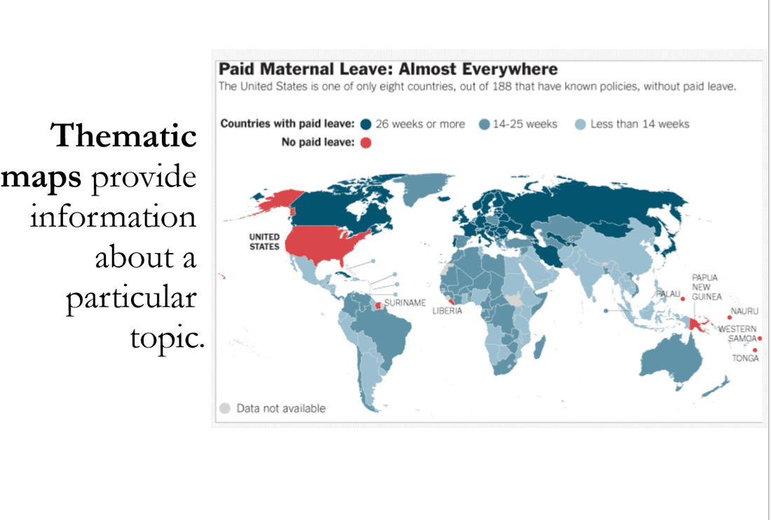
Part 1 - Political Maps Will be uploaded shortly Part 2 - Physical Maps Assignment: Physical Maps: Mapping the Iditarod Trail How to download the Google Earth Iditarod KML file: Follow this link and then click the "Google Earth file" link under the Iditarod 2007 section. It is the link with the little globe next to it. That is a KML file that will automatically upload into Google Earth. Continue following the directions on your handout. Part 3 - Thematic Maps Website Link of interesting thematic maps Assignment: Thematic, Physical, and Political Maps |
|


Unit Test Review
Practice Test
Practice Test
Unit Project: Maps - Tools of Adventure
This unit project will be worked on throughout the unit. As we finish each module, students will work on that aspect of the project.
Students will start out the project by making a small book of blank paper to record their information. As they move project module they will cut out each question and glue it into their book. They will then answer the question in the book.
Book Creation - Student will take at least 10 pieces of paper, stack them on top of each other, and will staple them together. Students will have access to a special stapler at school to staple them.
Module 1
Module 1 Directions and rubric
Module 2
Module 2 Directions and rubric
After exploring the links below, choose a map projeciton that you think best fits your needs and has minimal distortion in the areas of the map that you want to use.
Ptolemy 1 Projection
Tristan Edwards Equal-Area Cylindrical Projection
Altoff Projection
Tissot Equal-area Conic Projection
Berghaus Star Projection
Strebe Equal Area Projection
|
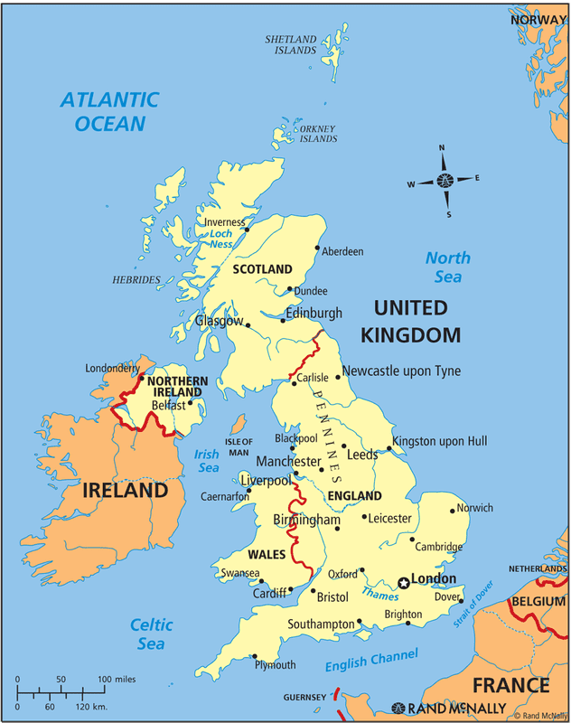
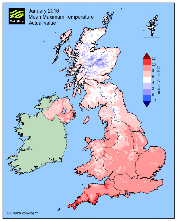
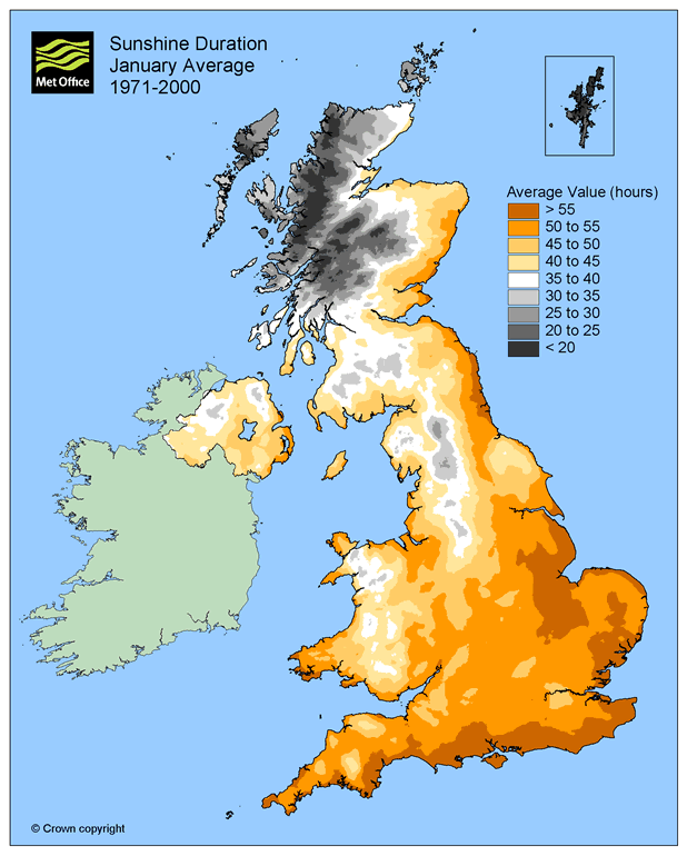
Module 3 Day 1 Module 3 Directions and rubric The the maps to the right to answer the questions in your journal. If you need some background info on the different countries that make up the UK, you can watch the video as well. Module 4 KMZ File: London Tube Google Earth Overlay London Tourist Attractions Map London Tube Map |
|


Above and Beyond:
If you would like to explore topics that we discussed in class, you can watch the videos below.
Want to learn more about distortion in projections? This link will teach you about Tissots Indicatrix. It is a cool way that geographers identify distortion.
If you would like to explore topics that we discussed in class, you can watch the videos below.
Want to learn more about distortion in projections? This link will teach you about Tissots Indicatrix. It is a cool way that geographers identify distortion.
Interesting Interactive Mapping Websites
NOAA Sea Level Rise Predictor Map
Sea Level Change interactive Map
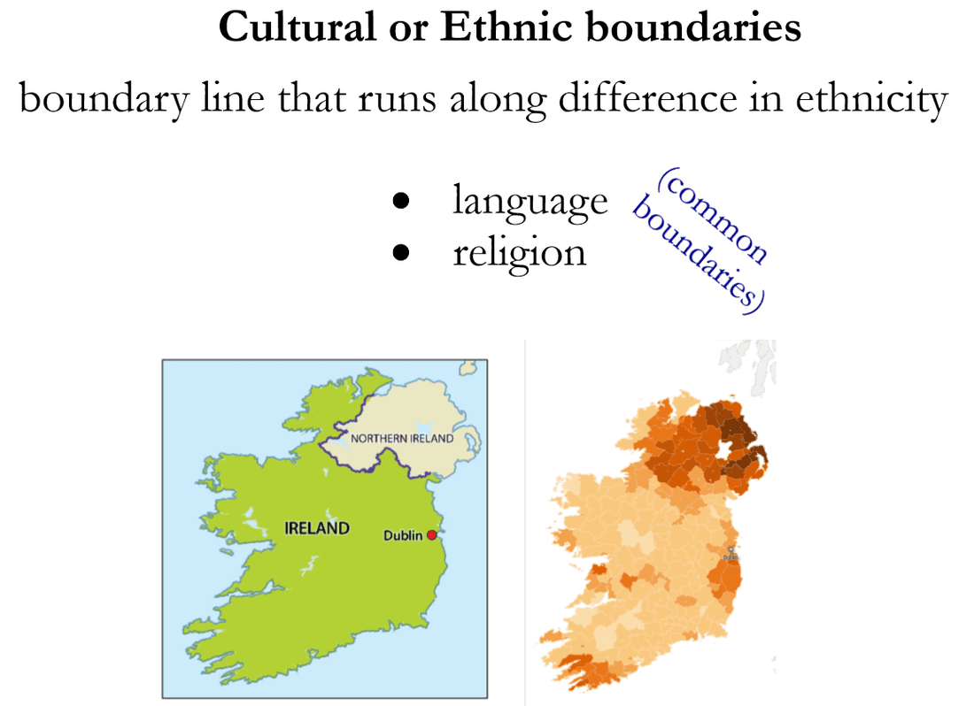
National Geographic information on borders
National Geographic interactive map maker
NOAA Sea Level Rise Predictor Map
Sea Level Change interactive Map
National Geographic information on borders
National Geographic interactive map maker
|
|
|
